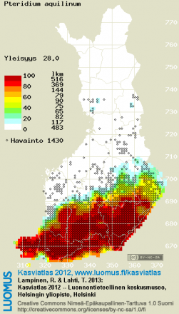
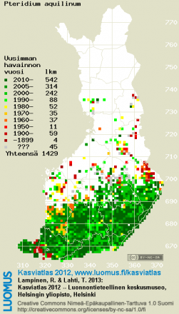
Atlas of the Distribution of Vascular Plants in Finland (Kasviatlas)
Kasviatlas, Atlas of the Distribution of Vascular Plants in Finland, provides different types of online maps of the Finnish vascular plant taxa in the 10 km x 10 km grid of the uniform coordinate system (ykj, kkj3). So far available in Finnish and Swedish.
Using the Finnish version, enter a taxon name of part of it into the 'Nimihaku' text box and press 'Hae' to get the list of matching taxa. Then click the taxon name to see the maps.
You can also get the lists of plants from each 10 km x 10 km square using 'Ruutuhaku' (with the number of records, calculated frequency, and the years of the first and latest record) as well as lists of plants with a calculated frequency of at least 20% but without actual observations ('Ruutupuutehaku').
The boundaries of the grid 10 km x 10 km, 1 km x 1km and 100 m x 100 m cells can be viewed here.

